Scaling spatial points — United States of America (USGS)
Overview
Working in collaboration with the United States Geological Survey, this case study provides an example of how to display a large number of stations appropriately, with more local detail appearing as users zoom in.
Provider
Publisher
USGS Water Services
Collaboration
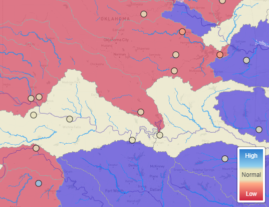
USGS daily hydrological status data can be called directly from the WaterWatch API. Percentile data is available via the API, however USGS convention does not match the percentiles that were agreed for the categorisation of products for HydroSOS, therefore the closest percentiles were taken (“below normal”, defined elsewhere as <33% made use of the 25th percentile, and “above normal”, defined elsewhere as >65% used the 75th percentile). The HydroSOS team developed a small Python script that processes the API outputs to percentile data for the map.
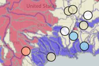
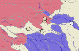
The WaterWatch service provides information for >3000 sites, too many to display on a global scale map. Therefore, sub-categorisation was agreed with the USGS. HUC classifications (Hydrologic Units) provided a means to select which sites would be displayed at different zoom levels, with more local sites being displayed the further in a user zooms, and sites that represent larger basins are displayed at a global scale zoom level. Dependent upon zoom level, HUC 2 (18 stations), 4 (approx. 200 stations) and 6 (330 stations) stations are displayed. All services with a large gauging network will need to consider appropriate modes of sub-setting their stations for spatial zooming when collaborating with HydroSOS.
HydroSOS integration steps
Loading....